

From Google Maps to Street View
Google has given life to many websites with its Google Maps, but they are now useless since MyMaps is here. Why is this technology so important?
In December 2011, MyMaps is replaced by MapMaker with a simplified interface. It is a set of tools to create your own maps. Intuitively
with the mouse, you can draw a road and place photos or videos. You may also
adds links to descriptive web pages.
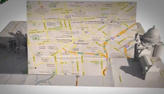
The map created can be integrated into the Google Earth service which is the
public displays of maps available to Google (see bottom of page). It could
also be placed on a Web site service provided so far by Google Maps.
You can use TileMill too (see links at bottom).
Google Maps is the most popular application of the Web 2.0 to create a mashup, a combination of functions in order to create a new service.
Content of the maps
They may have the following elements: landmarks, lines, forms completed by
a descriptive HTML text or not, photos and videos.
The design is done with an online tool that looks like a vector drawing software.
A new card is created by giving a title and description, then buttons are
used to place an online form, a picture, and so on. One may subsequently selects
elements to edit, move.
You also have a manager to manage the cards that you have created.
Photos and videos must be stored on-line to be usable. This can be done with
Picasa. They are associated with a landmark placed on the map.
A wiki of cartography
The map is available on the space provided by Google, it is enough to provide
the URL to share it with others. It is possible to define your manager with
different authorization levels, public or private, on the map. The public
maps are taken into account by search engines, private maps are viewed only
by those who know the URL.
At first glance, maps created are not included in the public version of
Google Earth. They can be included on your version of the software installed
on your computer, for your personal use. And of course, they are displayed
individually on the Web.
So Google by centralizing the work of Internet users around a single tool is creating a kind of encyclopedia of Geography, or more precisely mapping enriched with photos and geographic texts. Something very better than that Wikipedia proposes!
Documents and tools
- Leaflet. JavaScript framework for displaying OpenStreetMap.
- Mapnik. Map renderer, allow to zoom, etc. Can be used with map built in TileMill.
Sky Map
- Source code. Sky Map is no longer developed by Google, but left to contributors.
Other online services
- OpenStreetMap. Free mapping service, competitor to Maps.
Street View
The Street View function is integrated in Maps and show 360° 3D view of a place. In 3D mode you can move through the streets of a city or a landscape, as long as Google's vehicles passed there with their cameras. They travel tirelessly all places of the world. We can thus see the world without moving, Jules Verne would have dreamed of!
Sometimes users are notified of their arrival and put unusual objects in their path ...
- Street View.
- To go anywhere, Streetview uses a tricyle. Video.
- Collection of amazing photos takens by the StreetView's cars.
- Visit the Hasima abandonned island. (Japan). After the closure of the colliery in 1974, the island is deserted.

Photo taken by a Street View car